Home
Day Walks
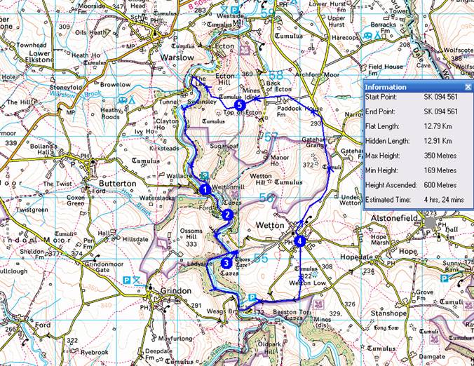
Sunday 10 December 2006 A 13km circuit from Wettonmill starting at 10.30 am
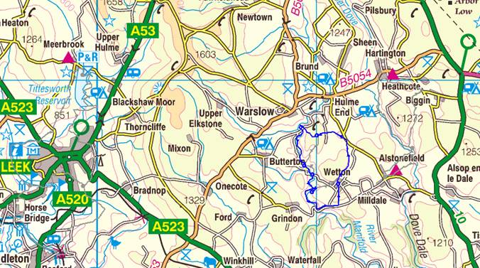
From Manchester, head to Macclesfield then take the A523 to Leek. Continue from Leek along the A523 towards Ashbourne, turning left about
4 miles beyond Leek, along the B5053. Go through the village of Onecote then (About 2.8 miles from the A523) take the 2nd right turn, down a lane to Butterton. Go through the village keeping to the left of the church, then take the next right towards Wetton. This is a steep narrow lane, go left at the bottom and park on the right past (not over) the bridge. Allow one and a
half hours from Manchester - that should leave time for you to stroll across the bridge to the café for sustenance before the walk (if it's open!).
Instructions (see
map below)
Start from the free car parking area at Wettonmill (SK 094 561), reached from Manchester via the A523 through Macclesfield and Leek, beyond which the B5053 is taken to get to Butterton before heading down narrow lanes to Wettonmill. Other routes use the A6, A515 and a selection of country lanes.
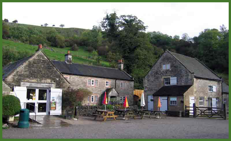
Rendezvous in the café over the bridge (Waypoint 1), hopefully open, with a view to departing down the tarmac lane, signposted
‘Wetton 1¼’, by 10.30. After 5 minutes cross a road (Waypoint 2) and carry straight on through a gateway along the course of the old railway on the west bank of the Manifold.
Mallard and grey squirrels abound.
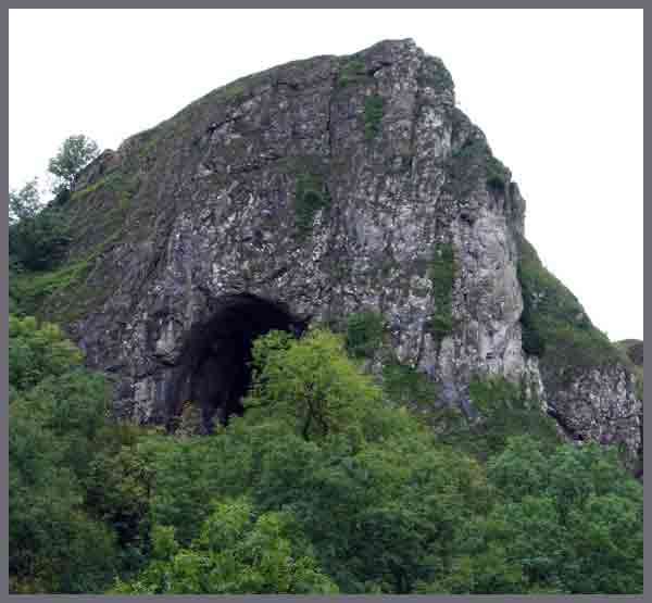 |
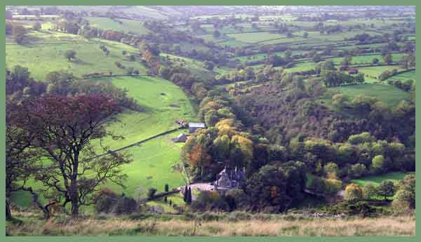
The gaping entrance of Thor’s Cave soon appears across the river on the left. After another 10 minutes, via a narrow bridge across the river, a side path leads up to the cave (Waypoint 3). Enjoy a visit to the slithery cave. Retrace your steps to the narrow bridge [alternatively amble directly to Wetton] and continue along the cycleway, perhaps amongst hordes of heavily laden youths on Duke of Edinburgh exercises, to reach a road at Weag’s Bridge. Go left over the bridge and up Larkstone Lane, looking out for Great Tits and other hungry birds on the feeders in the ‘nettle zone’ to the left of the bridge. The river may have disappeared here due to the porous nature of its bed. Go over a cattle grid and immediately left, at last leaving the tarmac, up a steep path through gorse. |
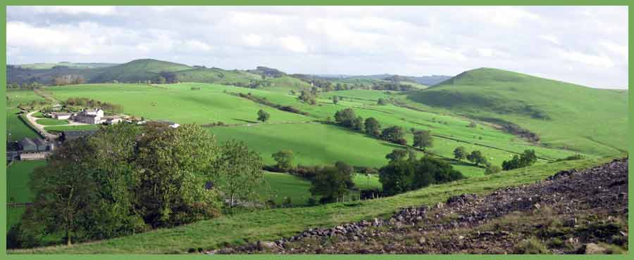
You’ll be pleased to regain the lane at the top, after which continue along it, in the company of circling crows and lolloping hares. Ignore a turn to the left, 500m after which you reach the brow of a hill and take a footpath left (north) towards Wetton.
Head diagonally across a field of cow pats towards an old barn that provides a refuge for sheep. Baggers may wish to visit the summit of Wetton Low, a Tumulus to the right at 322m, but normal people will pass by the barn, beyond which the sleepy village of Wetton with its single ‘fleshpot’ now appears.
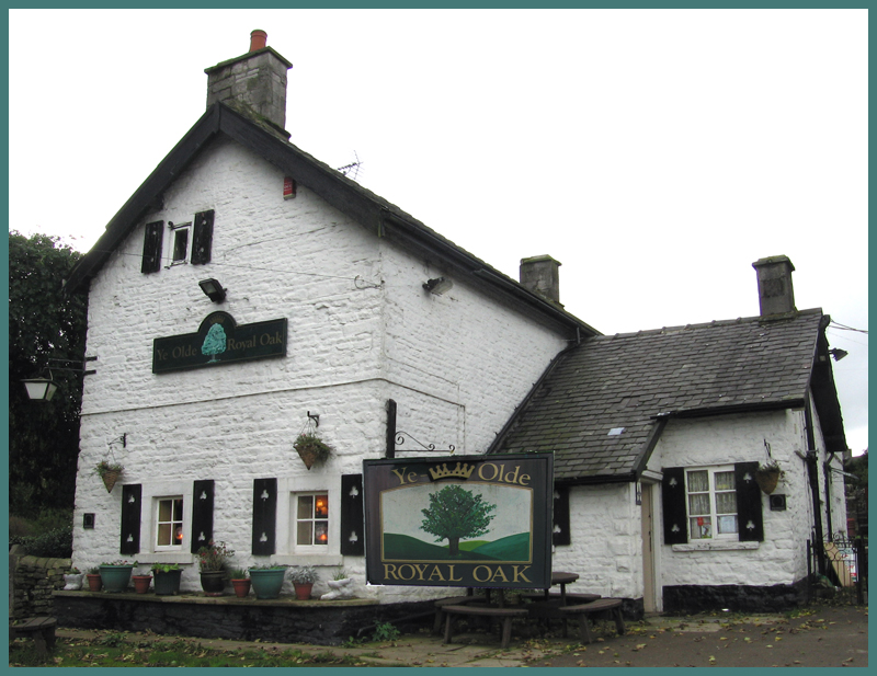
Continue along grassy tractor tracks, past a lone hawthorn tree and over more stiles to reach the welcoming blue bootees and roaring fire of Ye Olde Royal Oak (Waypoint 4), where a bar meal and a choice of real ales await the weary walker.
After satiating all your needs, continue this pleasant stroll by heading up the road towards the church.
Pass a sign to ‘Back of Ecton 1½’ and then turn immediately right and follow a nicely stiled path towards Gateham Grange to the NNE. Continue until reaching a double stile, wooden and stone, by a sign indicating that you are at the edge of the National Trust’s Wetton Hill land. (Baggers may wish to nip up Wetton Hill – 372m - from here.)
Do not cross the stiles, instead go ahead to the left of the wall, leading to a muddy gateway by an electricity pylon, then beside the right hand wall to cross that by an elaborate stile.
A diagonal tramp across the field leads to another stile in the far corner, beyond which Mallard and Lesser Black-backed gulls may be frolicking in a small pond. Continue in the same direction towards the road but when reaching it don’t join it. Instead take the path at 90º to the one you arrived on, across lush grass to a gateway where the spire of Butterton Church comes into view.
Don’t go through the gateway; keep to the right of the wall, past cows and calves and an inscribed trough, to reach a stile over the adjoining wall. Continue in the same direction, seemingly to the right, to pass to the right of the next buildings, Paddock House Farm. The marked footpath contorts its way around the farm.
After a wooden bridge keep left beside the wall towards the farm’s outbuildings, veering right if necessary to avoid a bull ensconced in a pond of slurry. Go through the gate next to the outbuildings and up the field to cross a road. Continue up a path to Ecton Hill (Waypoint 5), noting the warning to ‘beware of shafts and hollows’.
It’s a short but steep climb, revealing some fine views.
Another stile leads to a short descent to Broad Ecton Farm, past some donkeys, then on in the same direction along a path signed ‘Summerfield and Lime Kiln’. Go up the hill (just about the end of this walk’s 600 metres or so of ascent), through a gate, and up to the left of the wall (not along the track) to a gateway with a fallen sign. Ecton Hill, 369m, is baggable from here, but those with sanity will prefer to head to the right of a broken wall then diagonally right (NW) across a field heading towards the village of Warslow which soon comes into view.
Now a steep descent past hawthorns leads to a contouring path to the right from which we soon depart to the left down slippery grass and through a scrubland of gorse and thistle leading down a prow to reach the Manifold Valley just north of Lee.
 |
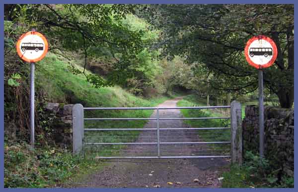 |
On reaching the road, turn left and then take the first left turn down a narrow lane marked emphatically as Not For Coaches. Keep along this nice leafy graveled track along the east bank of the river, eventually reaching Dale Farm, where a right turn leads back to the car parking area.
Total trip - 13km, 600 metres ascent, est'd time 4 hrs 30 mins
Timing is based roughly on Naismith's calculation of 4.00 Km/hour
and 600 Metres ascent adds an hour.
NB Naismith standard is 5 kph; the above
timings include stops other than lunch.